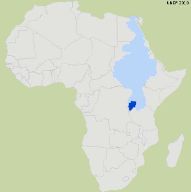
The river basin covers some 60,500 km² and is estimated in 2007 to have a population of nearly 15 million people. The Kagera basin covers portions of the four countries of Burundi, Rwanda, Tanzania and Uganda. The basin covers 75% of the land area of Rwanda and 52% of Burundi lie within the basin.
The most significant part of the basin is cultivated agricultural lands (48%), followed by natural vegetation (26%), of which 2% is covered by closed forest vegetation. The drainage density in the catchment areas of Nyabarongo, Akanyaru and Ruvubu is very high, particularly on the eastern part of the Congo-Nile Crest.
Although the western part of the basin is partly forested, much of the basin has become intensively cultivated and even fragile lands located on steep slopes are cultivated.
Increasing pressure on the natural resources
The natural resources in the basin face increasing pressure as a result of rapid population growth, intensification of agriculture and livestock activities and unsustainable land management practices. The mean annual demographic growth rate in Kagera catchment is 2.7% and the fertility rate per woman is 6.34. The rates are higher when compared with Sub-Saharan countries where the mean population growth rate is 2.5% and the mean fertility rate is 5.4.
The basin is an important source for hydropower especially at Rusumo waterfall. Around 14 million people, most of them subsistence farmers, live within the catchment.
There is persistent land degradation in the Kagera River Basin, accompanied by serious loss of biodiversity and impacts on the agro-ecosystems that are affecting the livelihoods of local people who largely depend upon the natural resources for their living.
Climate change and its impact on water resources
The impact of climate change on the intensity and frequency of precipitation extremes and daily maximum temperatures are projected to be significant. The wet-spell length for each of the seasons is expected to reduce implying longer dry spells for most of the months and this is related to the projected increase in the mean daily maximum temperature.
WACDEP implementation
Water professionals should take into account the expected impact of climate change on the precipitation extremes as it will significantly affect the storm design curves which are very useful for many engineering applications.
Water managers should properly plan for extreme precipitation events which are expected to result in floods and landslides and thirdly farmers may advised to take into consideration the changing climate and the expected influence of projected climate change on the frequency of extreme precipitation and change in the wet spells.
WACDEP can intervene in combating soil erosion and designing flood management strategies and can liaise with Kagera Project Management Unit and the 4 riparian countries.
