Green + Water
THIS IS A TRANSLATION - THE STORY WAS SUBMITTED IN SPANISH
Please briefly describe your Water ChangeMaker journey
Please describe the change that your initiative created and how was it achieved
How did your initiative help build resilience to climate change?
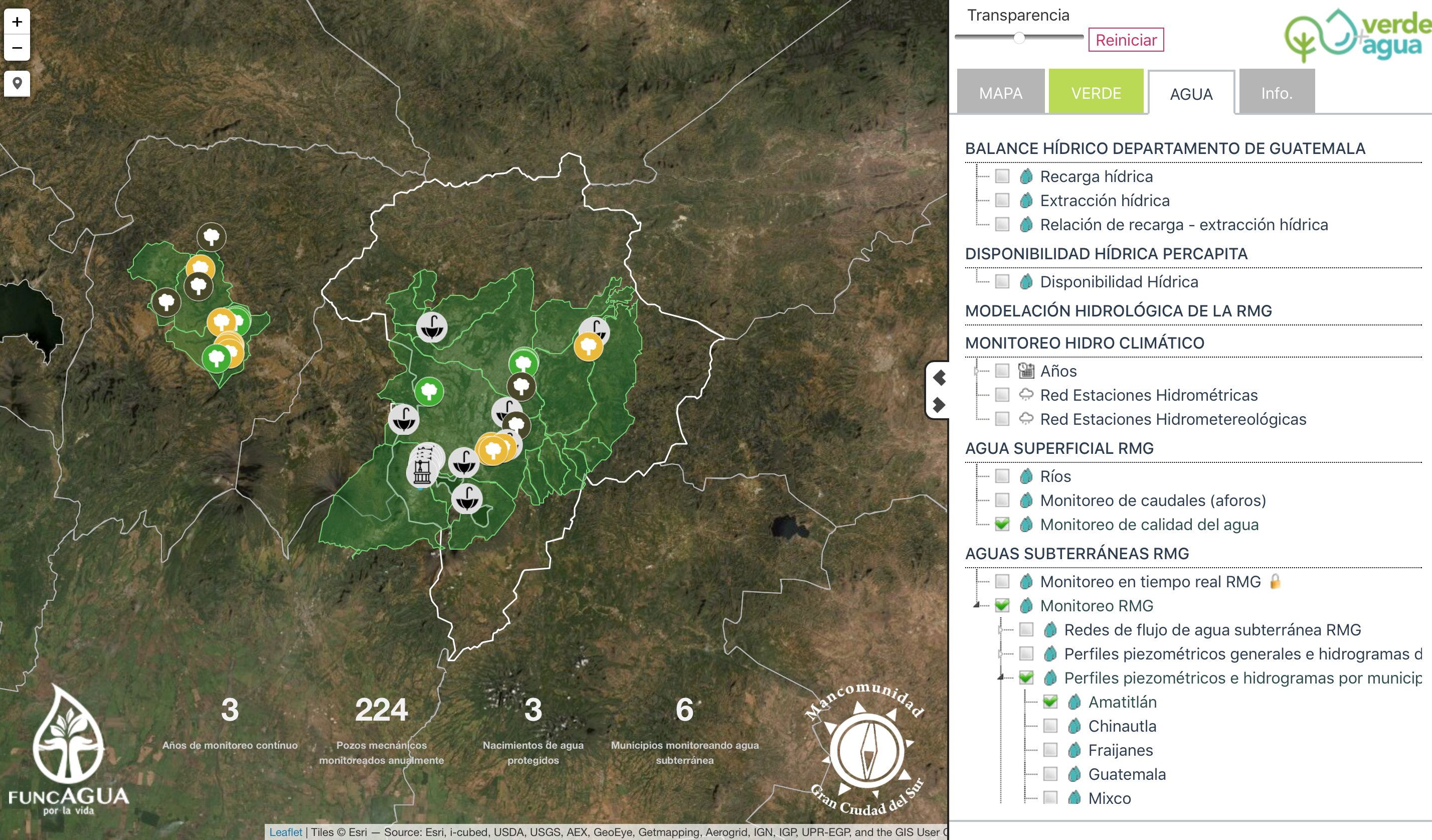
With this visual information (piezometric profiles of the wells can be seen on the map, which makes it possible to know the condition of the aquifer), decision makers have access to current data, enabling them to make the best decisions, such as when construction licenses can no longer be granted because the aquifer’s carrying capacity no longer permits it, or not to allow the drilling of wells and to propose another closed-system water supply mechanism (purification of wastewater, for example). Thanks to this green theme, which includes forest activities, it is possible to visualise needs to guide more green infrastructure action, since land-use changes (construction, paving, etc.) are making water recharge areas impermeable. This platform makes all these actions visible and helps to improve and refocus proposals.
What water-related decisions did your initiative influence or improve?
Access to current, systematised data, and, in the future, real-time information will provide a clear picture of the location and condition of water (surface and groundwater) in terms of both quality and quantity. Having a platform that provides us with real, easy-to-interpret information through graphics contributes to the right decisions being made. Real data with graphs showing results also help standardise different actors’ activities.
What were some of the challenges faced and how were they overcome?
Verde+Agua [Green+Water] was launched as a simple platform to monitor green actions. However, the idea is so innovative and useful that it was gradually expanded to become a monitoring platform for both green actions (green infrastructure) and water actions (which will include traditional infrastructure with wastewater treatment plant locations). The idea of being able to have general information on a basin, without having to show specific data from individual actors, was what attracted most people to join. Initially, companies and municipal entities were concerned about sharing their data. However, we explained that individual activities will not be made visible, but that data averages will be displayed in order to understand basin dynamics, mainly relating to groundwater. The agent of change was the power to bring different actors together to share information. As a foundation, we also offer confidentiality agreements so that actors feel confident that their data will not be published, while knowing that their data really add to the aquifer’s general dynamics, which is what is visible on the platform.
In your view: Will the change that was created by your initiative continue?
We believe that this platform will bring about positive change for users, as it will reveal the impacts of individual activities on the basin as a whole. So regardless of whether individual activities have negative impacts, we will use the platform to promote the notion that individual activities can positively benefit all. This allows us to show how the sum of good actions can contribute to the well-being of all inhabitants of the basins involved in this platform.
What did you learn during the initiative or after? And is it possible that others could learn from you?
United we stand. Unfortunately, there are also actors who have individualistic motives and are not interested in the common good, or who believe that natural resources are there to be exploited or over-exploited. Fortunately, such actors were in the minority. This technological tool will also produce an annual report that we have named Verde+Agua [Green+Water], which will interpret what the platform has recorded throughout the year using graphics and text. We believe that this type of annual report is necessary for us to understand the state of natural resources, which for this platform, is forests and water.
