Its central objective is to strengthen the national early warning system for floods, by combining innovative technologies (low-cost sensors, remote sensing, deep learning) and strong mobilization of local stakeholders.
Implementation process
The project was deployed in several methodological stages:
- Mobilization and coordination: kick-off meetings, creation of a working group by the AEDD, involvement of stakeholders.
- Data collection and analysis climate, hydrology, topography, land use and socio-economics, supplemented by historical data and reanalyses.
- Risk characterization: frequency analyses, identification of sub-basins, mapping of exposures (schools, hospitals, roads, markets, etc.).
- Integration with existing systems: diagnosis of the national EWS, interoperability with hydrological models (HBV, GR4J, HEC), definition of vigilance thresholds.
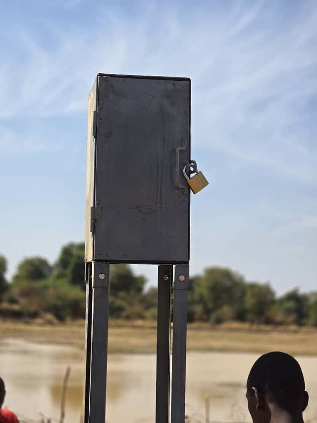
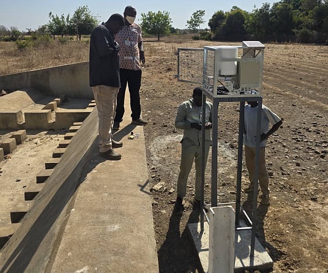
- Technology deployment: installation of hydrometric stations and GSM sensors, development of the SAPCI platform for forecasting and alerting.
- Capacity building: training of six technical managers in the use of the platform and hydrological models.
This led to the following results:
- Operational infrastructure: two hydrometric stations installed in Koula, functional sensor network.
- Digital platform: SAPCI is operational and currently being integrated with national systems.
- Validated mapping: methodology established and risk maps produced for the pilot commune of Koula.
- Enhanced Expertise: national and regional team mobilized, national diagnosis of surveillance systems validated.
- Increased local capacities: training of technical managers and appropriation by local actors.
Among the difficulties encountered, we can mention:
- Limited access to certain meteorological data, requiring the use of alternative sources (GloFAS, IFS).
- Occasional delays in the acquisition of essential equipment.
The implementation of the project yielded several major lessons:
- Local ownership and inter-institutional coordination constitute the essential foundations to ensure the sustainability of the system.
- The use of simple and accessible technologies facilitates their use and encourages the continuing education of stakeholders.
- Regular maintenance and the guarantee of recurring funding are essential to preserve the durability of the installed equipment.
- System interoperability appears as a key condition for effectively integrating innovations into the national PGRCI system.
- Dynamic mapping: It is emerging as a strategic tool to anticipate impacts and guide decisions regarding risk management.
As the project nears its end, several courses of action emerge:
- Finalize the data sharing protocol between Mali Météo and the DNH, in order to ensure the continuity and reliability of the alert system.
- Extend the methodology and platform towards other vulnerable municipalities, to expand national coverage and strengthen the resilience of exposed territories.
- Institutionalize continuing education and alert exercises ensuring the maintenance of the skills of the actors and optimal responsiveness in crisis situations.
- Implement a system for regular maintenance and calibration stations and sensors, accompanied by a dedicated budget, in order to preserve the durability of the equipment and the quality of the data collected.
In conclusion, the AFCIA Mali project illustrates how technological innovation, combined with strong institutional and community mobilization, can transform climate risk management in West Africa. By equipping Koula in Mali with modern forecasting and early warning tools, it offers a replicable model for other vulnerable areas. The sustainability of these achievements will depend on strengthening partnerships, maintaining infrastructure, and scaling up the methodology nationally.