According to the figures available, floods of fluvial and pluvial origin cause loss of life and property in Mali almost every year. In 2018, more than 3,800 houses were destroyed and 70 water points damaged, 1,700 head of livestock perished, and more than 10,000 households were affected. In 2017, more than 11,000 people were affected by flooding, mainly in northern Mali. In 2024, thousands of Malians have been affected, forcing the government to postpone the start of the 2024-2025 school year, originally scheduled for 2 October, to 4 November. Several schools are still under water or occupied by flood victims.
 As throughout the Sahel, there has been a marked increase in the frequency and severity of floods in Mali. Climate projections also suggest that extreme rainfall (and hence flooding) will become more frequent in the future.
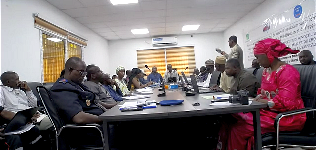
The AFCIA project is part of the drive to reduce the impact of flood risks by setting up an early warning system. The aim of the workshop, which is being held this 17 October 2024 in person at Mali's Direction Nationale de l'Hydraulique (DNH) and online, is to strengthen the existing early warning system for the risk of flooding in Mali on the basis of rainfall and water level forecasts, with the help of remote sensing and deep learning.
 This led both the Deputy Director General of the Agence de l'Environnement et du Développement Durable (AEDD) and the Chairman of PNE Mali to say at the opening that ‘this workshop comes at the right time’. The main objective of the stakeholders' technical workshop is to present the provisional version of the diagnostic report on flood monitoring and forecasting systems in Mali, together with the data to be generated to enable the definition of a high-performance hydrological model for the pilot municipality to be selected in a concerted manner, and to agree with the participants on the improvements and enhancements required.
 The workshop is being held as part of the implementation of the AFCIA-Mali project, financed by the Adaptation Fund through the Adaptation Fund Climate Innovation Accelerator (AFCIA) programme to the tune of around US$200,000. Activities started in March 2024 and will end in August 2025. The implementing partners are AEDD, Mali Météo, DNH, and the executing partners are the UNEP Climate Technology Centre and Network (CTCN) with technical assistance from the Global Water Partnership in West Africa (GWP-WA).
 The specific objectives of the technical assistance provided by GWP- WA for the implementation of the project are as follows: (i) to collect accurate data and develop a hydrological model using deep learning models in a municipality in Mali (to be confirmed on the basis of a diagnosis) using satellite and drones data; (ii) to characterise precisely the types of infrastructure in at-risk areas; (iii) ensure the integration of a hydrological model and the flood alarm system of the Climate Risk and Flood Management Project (PGRCI) in the selected rural commune; (iv) implement a low-cost hazard monitoring technology based on the use of microcontrollers connected to a pressure sensor and a GSM card to transmit water levels in the selected area.
 Project activities began with the setting up of a team of consultants, the collection of data and information from the structures involved in flood management in Mali, and the drafting of the diagnostic report on flood monitoring and forecasting systems in Mali, with the identification of the data to be generated for the choice of the high-performance hydrological model to be developed for the pilot commune following its selection.
 Thus, planning and communication documents will be developed; a diagnosis of flood monitoring and forecasting systems in Mali and identification of the data to be generated to enable the definition of effective hydrological models in the pilot municipality will be carried out; the data needed to develop the hydrological model for the pilot municipality will be collected; a hydrological model for the pilot municipality will be developed. The hydrological model and the flood early warning system of the Climate Risk and Flood Management Project in Mali (PGRCI) will be integrated in the pilot commune, and finally the tools to create a favourable environment will be prepared.
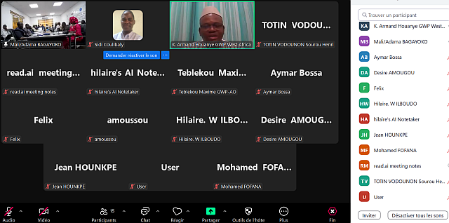
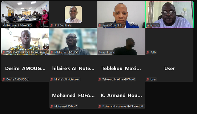
 The meeting on 17 October 2024 was attended by some thirty (30) participants from national bodies including AEDD, DNH, Mali Météo, the Directorate General of Civil Protection (DGPC), the Early Warning System (SAP) Mali, the National Platform for Disaster Risk Reduction, the Directorate General of Health, the National Directorate of Agriculture, the Ministry of the Environment, the Ministry of Health, the Ministry of the Economy, Finance and Industry, the Ministry of the Economy, Finance and Industry and the Ministry of the Economy, Finance and Industry, the National Directorate of Agriculture, the National Directorate of Urban Planning and Housing, the National Directorate of Land Management (DNAT), the Mali Geographic Institute (IGM), the Mali Red Cross, Plan Mali / Caritas Mali, the Niger River Basin Agency (ABFN), CWP-Mali and the GWP-WA team, including national and regional consultants.