The rivers are the Pregola, which passes through the Kaliningrad enclave (Russia), Poland and Lithuania, and the Neman with its basin in Belarus, Lithuania, Kaliningrad Oblast and Poland. These rivers bring their waters into the Baltic Sea without stopping at the administrative or political boundaries, so collaboration is needed. This is why the project was initiated, with funding provided by GWP.
The project – running under the title “Development of GIS communication technology platform and database for transboundary Neman and Pregolya river basins” – consisted of two successful workshops, which resulted in a series of tools:
- 30 GIS maps (short for Geographic Information System) of surface and groundwater, human pressures and impacts, maps of climate change, chemical and ecological status of water bodies
- A interactive map and database
- A video film on GIS mapping and transboundary cooperation
The GIS maps were shared among stakeholders in the project countries, and they will be included in the second round of Neman's and Pregolya river basin district management plans. The maps will be used in programmes run by Lithuania and Poland under the EU Water Framework Directive.
Thanks to the collaboration, links have improved between water management and GIS experts of the neighboring countries. During the first river basin planning round (2009-2015) there was little cooperation between Lithuania, Poland and their non-EU neighbors. The GIS project is a good example of transboundary cooperation between EU and non-EU countries.
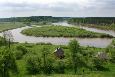
Top photo: The view of Neman river from the top of Merkine mound, Lithuania.

