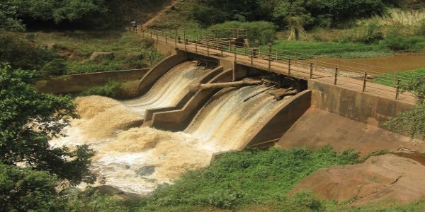
Rain that falls within a region is naturally caught and distributed by rivers, streams, and other watercourses, with all the water ultimately running off to a single outlet. The geographic area that contributes to this process is called a catchment, and integrated catchment management aims to manage all components of the hydrological cycle that operate there, such as evaporation, precipitation, runoff, and infiltration. This also includes human activities like farming, construction, and forestry that have an impact on these components. The scale of catchment management has to be large enough to capture all interacting elements, but limited to ensure that people who live in the area can easily relate to what happens there.
Integrated catchment management has become accepted as the best way to manage water resources sustainably because the approach considers the most important factors – hydrology, climate, socio-economic activity, ecosystems, governance, and administration – and encourages public participation and transparency in decision-making. The approach also makes it easier to plan for the complex effects of climate change.
Uganda’s Maziba, Aswa, and Awoja catchments are home to some of the most vulnerable people in the country, many of them small-scale farmers or herders in the regions’ highlands, wetlands, and savannas. The three catchment areas characterise a spectrum of livelihoods and states of catchment health, ranging from densely populated high slopes and degraded areas dominated by crop farming to semi-arid mixed agriculture. Use of the land and water in these catchments has intensified over the past 50 years, with cultivated fields climbing to the top of mountains and creeping to the edges of rivers and lakes.
People have cut many trees to make charcoal for cooking. When the rains come there is little vegetation to hold the water, so fields and buildings are flooded, and life-threatening landslides bring rivers of mud and debris to settlements. Rivers and streams become clouded with sediment that makes the water unusable and eventually leads to more flooding. Increasingly erratic rainfall is bringing drought episodes to this land of formerly plentiful rivers and lakes, while the melting of mountain ice caps has increased flooding and threatens reduction of the water stored long-term as ice.
Protecting fields and forests
WACDEP’s assessment of priority climate and water issues in eastern Africa identified these conditions in Uganda’s major catchments as needing urgent attention. WACDEP looked for a partner that could work with Uganda’s Ministry of Water and Environment to apply an integrated catchment management approach to the regions’ problems. The right partner was found in the Sahara and Sahel Observatory (OSS), an accredited climate finance broker for both the Green Climate Fund and the Adaptation Fund. GWP Eastern Africa, working with OSS, supported Uganda’s lead ministry in preparing an integrated catchment management project proposal that was compatible with community needs.
In 2017, a four-year programme, Enhancing Resilience of Communities to Climate Change through Catchment Based Integrated Management of Water and Related Resources in Uganda (EURECCCA), was launched. Its support by the Adaptation Fund of US$7.75 million was a first for Uganda.
The design of the EURECCCA programme has built on Uganda’s existing framework for integrated water resources management; it is integrating climate change adaptation in the catchment management plans for Awoja and Maziba, and developing a similar plan for Aswa that addresses linkages between land use and water resources. The programme is designed to facilitate engagement among the Ministry of Water and Environment, Ministry of Agriculture Animal Industry and Fisheries, local government staff, catchment management committees, communities, civil society organisations, and the private sector, all to increase resilience of ecosystems, agricultural land, and community livelihoods to climate change.
Building the capacity of extension services and institutions at local catchment levels, water management zones levels, and national levels to better support local stakeholders is a key goal of the programme. In each of the three selected catchments, particularly vulnerable hotspots have been identified – in the highlands, the midlands, and the lowlands – to ensure that the programme addresses the need for catchment management at an appropriate scale.
Learning for the land
Reforesting the regions’ slopes, restoring ecosystem services, and taking up new livelihood options require intensive learning. Therefore, the GWP Eastern Africa team not only provide strategic guidance through the project steering committee but also support capacity building and knowledge management, especially focusing on rural extension services. This work has included a capacity needs assessment, delivery of training modules, training of trainers, and documentation of good practices and lessons learned.
The programme is leading to better control of floods and landslides across agricultural landscapes and to diversification of livelihood strategies. It is also building capacities of extension services and institutions at different levels, including sub-catchment, catchment, water management zone, and national. While the end goal is to support local communities and manage knowledge, it has become clear along the way that building the capacity of government agricultural extension services is leading to better support of local stakeholders.
From problem identification to programme implementation, GWP Eastern Africa, through WACDEP, has been able to ensure that Uganda is supported in its drive to address climate change using stakeholder-driven, integrated catchment-based planning, development, and management of water and related resources.

